
EAST VIEW MAP LINK
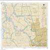
NOAA Chart 18663-San Joaquin River Stockton Deep Water Channel Medford Island to Stockton- Water-Resistant - by East View Geospatial
598,26 €
997,10 €
-
 Order within 7 hours and 40 minutes to get between June 16 - June 22
 -
 Tracked Shipping on All Orders
-
 14-Day Returns
- Secure Payments
-
 24/7 Customer Support
Description
- Printed on PaperTyger, a lightweight, tear-resistant, water-resistant paper with a smooth matte paper feel.
- Printed on demand using the most up to date NOAA data and latest Notice to Mariners (NTMs) applied at time of print.
- Meets United States Coast Guard carriage requirements.
- Pre-production finishing for superior quality.
- Printed by East View Geospatial. Map scale: 1:20,000. Map size (inches): 90 x 114.
Shipping and Returns
- We offer tracked shipping on all orders. Tracking information will be shared as soon as the order is dispatched.
- Please check the delivery estimate before adding a product to the cart. This is displayed for every product on the website.
- Available shipping methods and charges will be displayed at the time of checkout, depending on your exact location.
- All customers are entitled to a return window of 14 days, starting from the date of delivery of the product(s).
- Customers are advised to read our return policy for details of the return process, eligibility, refunds as well as cancellations or exchanges.
- In case of any issues or concerns about Shipping or Returns, please contact us and we will be happy to help.
East View Map Link.
NOAA Chart 18663-San Joaquin River Stockton Deep Water Ch...
598,26 €
997,10 €